| Home Page
My Uncle in The Bulge
Maps
Sign My GuestBook
View GuestBook
Contact Page
|
|
This page shows several maps of key events of the Battle of the Bulge. Included are the formation of the "Bulge" itself and the 4th Armored's drive to Bastogne to link with the 101st Airborne Division. |
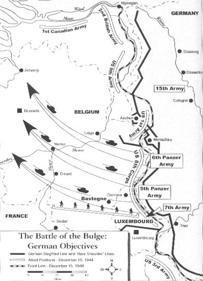
Formation of the German "Bulge"
On December 16th, 1944, the German Army launched an offensive along an 80 mile front in the quiet Ardennes Forest.
|
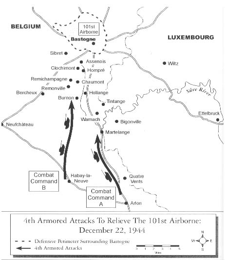
The 4th Armored's Advance on Bastogne
Patton's 4th Armored Division turned north from the Saar with the objective of reaching Bastogne to relieve the surrounded 101st Airborne. The 101st held out doggedly against enemy forces and refused a surrender ultimatum by the German commander. On December 26th, the 4th Armored finally reached Bastogne to further shore up Allied control of this vital crossroads.
|
|
The above maps are from the book "Patton and the Battle of the Bulge" by Michael and Gladys Green
|
|